
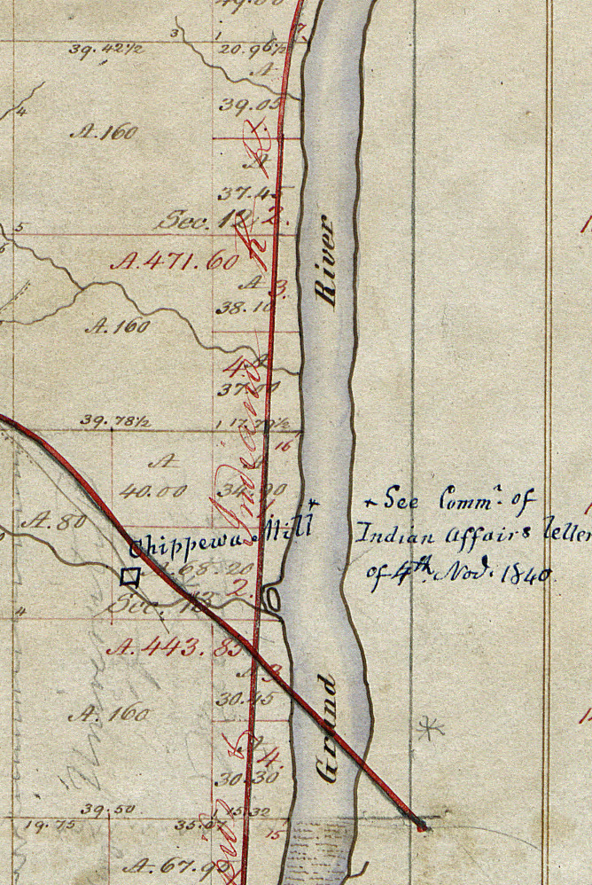
Survey Map, Sections 12 & 13
US Government - 1837
In 1833 Daniel W. Coit patented land on the both sides of the Grand River in sections 12 and 13 of T7N R12W as well as adjacent land to the east in sections 7 and 18 of T7N R11W. This map does not show the area on the east side of the river. Coit's land ran two miles north from the top of the rapids on both sides of the river. The crossing red lines on the map, depicting the Grand Rapids & Indiana Railroad running north and south and the Detroit & Milwaukee Railroad running northeast to southwest, were added to the map much later.
Subjects
Full Details
| Title | Survey Map, Sections 12 & 13 |
|---|---|
| Creator | US Government |
| Date | 1837 |
| Format | Digital image downloaded from the Bureau of Land Management web site. |
| Notes | Title by cataloger. The notation dated 1840 and the Chippewa Mill were obviously added after the survey map was drawn as were the rail lines. The GR & Ind. line began in 1867, and the Det. & Mil. line in 1858. |
| Location In Photo | Grand Rapids |