
Plainfield-Sheridan Indian Trail, Stage & Mail Route: west of Old US 131
Emory V. Houk - 1974
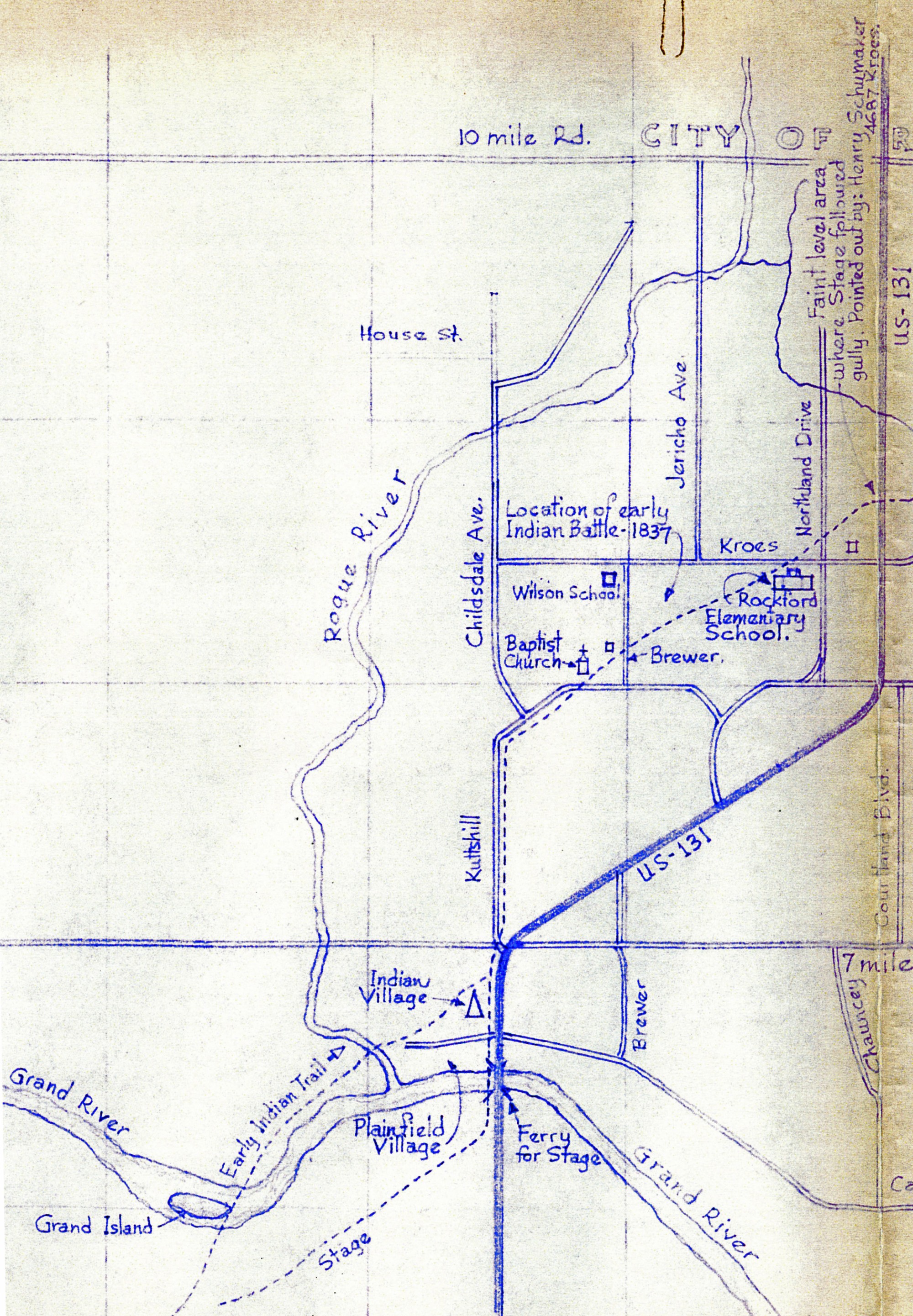
The city of Rockford is located north of 10 Mile Road. The city of Grand Rapids is to the southwest. The dotted line that runs disgonally across the map from the lower left is an early Indian trail that merges with the stage coach trail. Streets, buildings, and other landmarks are noted on the map. The Rogue River flows south and meets the Grand River at Plainfield Village. The map was researched and drawn by Emory V. Houk on Nov. 11, 1974, and was traced by R. T. Klawieter.
Subjects
Full Details
| Title | Plainfield-Sheridan Indian Trail, Stage & Mail Route: west of Old US 131 |
|---|---|
| Creator | Emory V. Houk |
| Date | 1974 |
| Format | Map |
| Notes | Title from map. The other half of the map, east of Old US 131, is also available in the photo archive. More about the history of Michigan roads. |
| Location In Photo | Plainfield Township |
| Collection | Kent County Road Commission, Grand Rapids, Michigan |
| Rights | Reproduction and copyright information regarding this image is available from the Kent County Road Commission, Kent County, Michigan |
| Institution | Kent County Road Commission, Grand Rapids, Michigan |
| Physical Storage Location | Grand Rapids, MI |