
Plainfield-Sheridan Indian Trail, Stage & Mail Route: east of Old US 131
Emory V. Houk - 1974
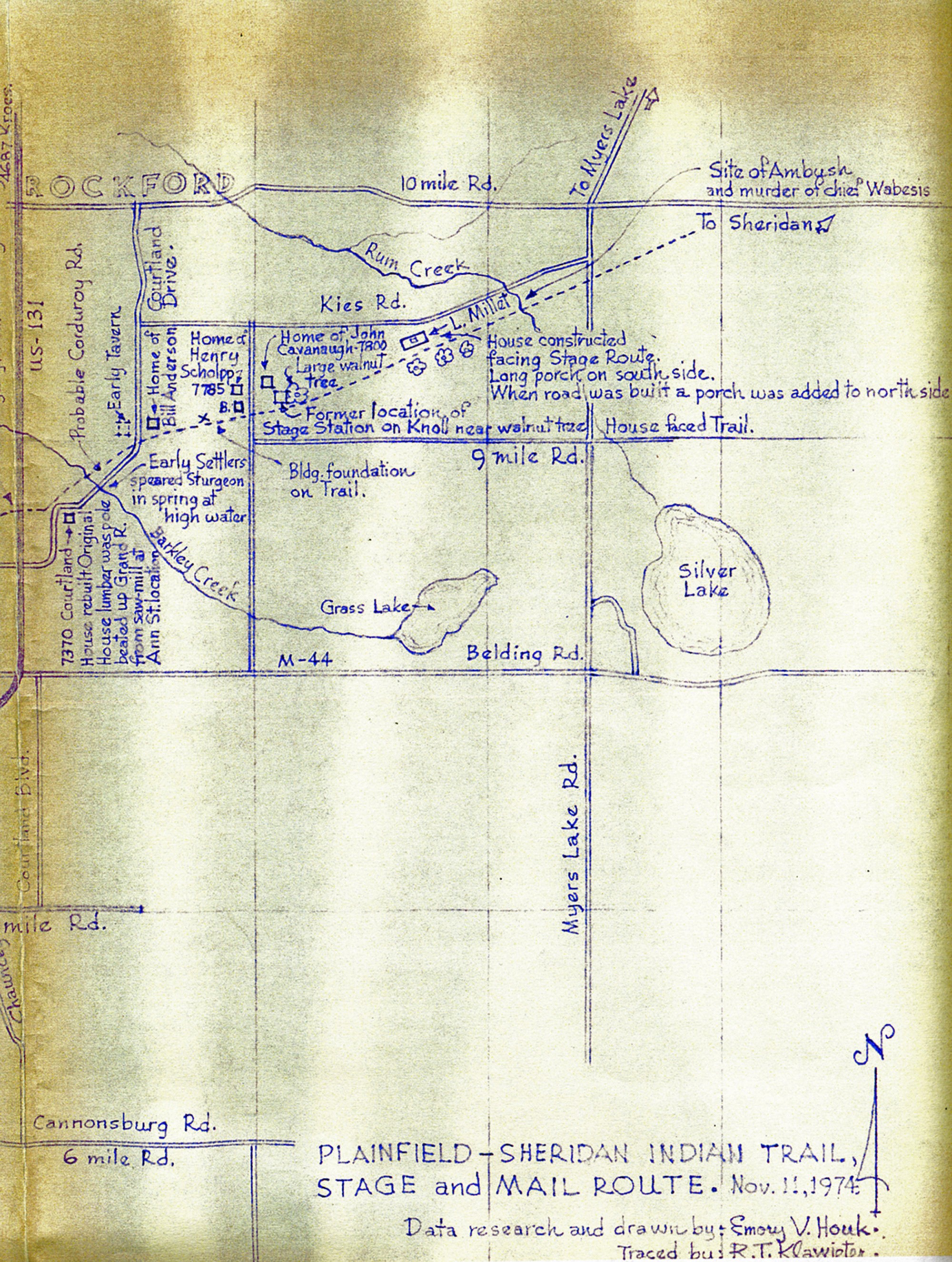
The city of Rockford is located at the top of the map above 10 Miles Road. The dotted line that runs diagonally across the map is the stage route that follows the original Indian trail. Notes on various properties and landmarks are printed on the map. Grass Lake and Silver Lake are shown as is Barkley Creek and Rum Creek. The map was researched and drawn by Emory V. Houk on Nov. 11, 1974, and was traced by R. T. Klawieter as noted in the bottom right corner of the map.
Subjects
Full Details
| Title | Plainfield-Sheridan Indian Trail, Stage & Mail Route: east of Old US 131 |
|---|---|
| Creator | Emory V. Houk |
| Date | 1974 |
| Format | Map |
| Notes | Title from map. The other half of the map, west of Old US 131, is also available in the photo archive. More about the history of Michigan Roads. |
| Location In Photo | Plainfield and Cannon Townships |
| Collection | Kent County Road Commission, Grand Rapids, Michigan |
| Rights | Reproduction and copyright information regarding this image is available from the Kent County Road Commission, Kent County, Michigan |
| Institution | Kent County Road Commission, Grand Rapids, Michigan |
| Physical Storage Location | Grand Rapids, MI |