
1912 Sanborn Insurance Map
Sanborn Insurance Co. - 1912
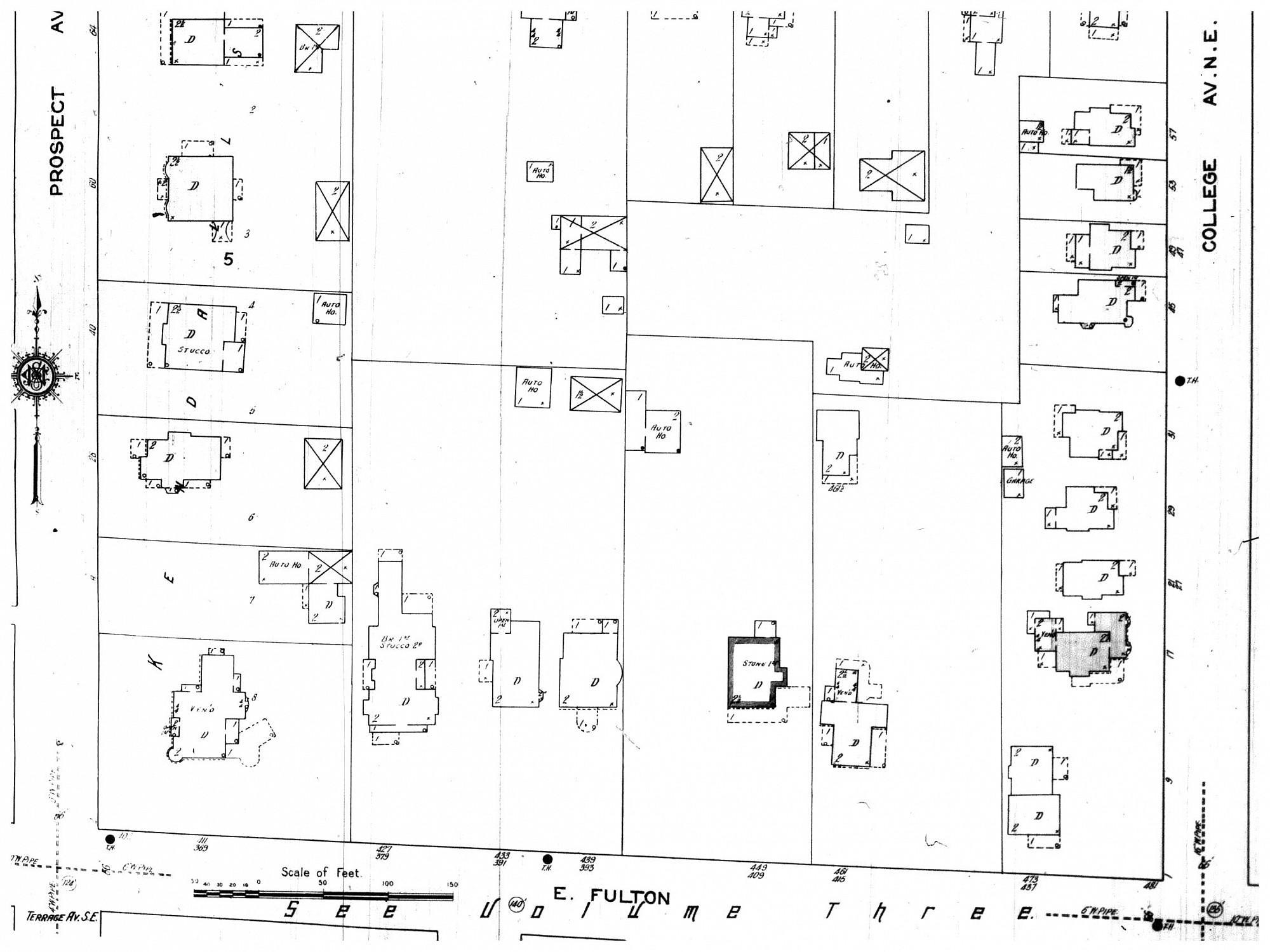
The Sanborn Map shows the outlines of seven homes on the north side of E. Fulton St. between Prospect and College Avenues. Under each lot, in small print that can be read with the magnifier in the Full Image view, are the addresses of each house. In 1912 the address system in Grand Rapids changed; the map shows both the pre and post 1912 addresses. The new 1912 address is on the top and the earlier one on the bottom. Some of the addresses changed in addition to the city-wide change. For example, the house fifth from the left at 449, became 455 E. Fulton when Charles Sligh built his home on the property.
Subjects
Full Details
| Title | 1912 Sanborn Insurance Map |
|---|---|
| Creator | Sanborn Insurance Co. |
| Date | 1912 |
| Format | Map |
| Notes | Title from document. When the address system changed in 1912, all numbering began from the corner of Division and Fulton, dividing the city into four quadrants. Even numbered houses were on the south and east side of streets; odd numbered houses on the north and west side. Streets ran east and west, and avenues ran north and south. |
| Location In Photo | Grand Rapids, MI. |
| Collection | Microfilm Collection, History & Special Collections Dept. |
| Rights | Reproduction and copyright information regarding this image is available from Grand Rapids History & Special Collections, Archives, Grand Rapids Public Library, Grand Rapids, MI. |
| Institution | Grand Rapids Public Library |
| Physical Storage Location | Grand Rapids, MI |