
Ottawa Band Seasonal Travel Map
Mark Cook
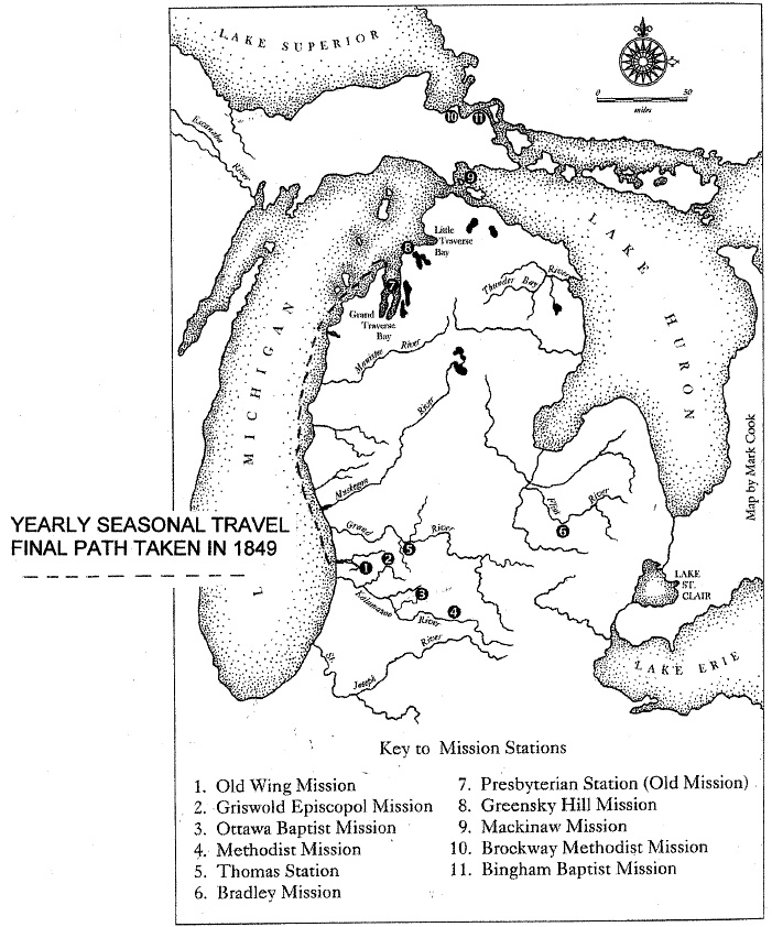
The map depicts the location of several Protestant mission stations in Michigan: Old Wing Mission, Griswold Episcopal Mission, Ottawa Baptist Mission, Methodist Mission, Thomas Station, Bradley Mission, Presbyterian Station (Old Mission), Greensky Hill Mission, Mackinaw Mission, Brockway Methodist Mission, and Bingham Baptist Mission. The dotted line along the eastern shore of Lake Michigan marks the final path taken to Northport in 1849.
Subjects
Full Details
| Title | Ottawa Band Seasonal Travel Map |
|---|---|
| Creator | Mark Cook |
| Format | Map |
| Notes | Title from document. Map is from Old Wing Mission: cultural interchange as chronicled by George and Arvilla Smith in their work with Chief Wakazoo's Ottawa band on the West Michigan frontier. Robert P. Swierenga & William Van Appledorn, editors. Wm. B. Eerdmans; 2008. (pg 14) |