
Sanborn Insurance Map
Sanborn Co. - 1895 (amended 1906)
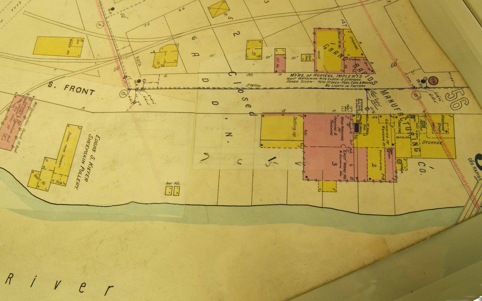
A portion of the amended 1895 map showing an area on the west bank of the Grand River along S. Front St. just south of the Pere Marquette Railroad Bridge. Two small rectangles near the edge of the river are labeled "Boat Ho's" indicating boat houses.
Subjects
Full Details
| Title | Sanborn Insurance Map |
|---|---|
| Creator | Sanborn Co. |
| Date | 1895 (amended 1906) |
| Format | Map |
| Notes | Title from document. The boat houses were used during the construction of the sternwheeler steamboats the "Grand" and the "Rapids" in 1905. |
| Collection | Community Archives and Research Center (CARC) |
| Rights | Reproduction and copyright information regarding this image is available from Community Archives and Research Center (CARC), Grand Rapids, MI |
| Institution | Community Archives and Research Center (CARC) |