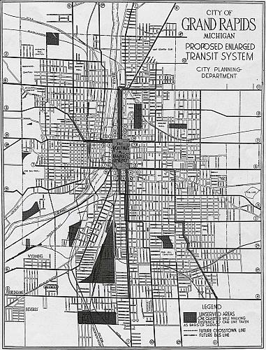
Grand Rapids Transit System Map
Grand Rapids City Plan - 1927
The map by the City Planning Dept. is described as the Proposed Enlarged Transit System. The legend indicates that the shaded sections of the map are areas not served by the system.
Subjects
Full Details
| Title | Grand Rapids Transit System Map |
|---|---|
| Creator | Grand Rapids City Plan |
| Date | 1927 |
| Format | Map |
| Notes | Title by cataloger. For an earlier map that includes streetcar lines see the "Grand Rapids Furniture Industry Map, 1897" at furniturecityhistory.org. |
| Rights | Reproduction and copyright information regarding this image is available from Community Archives and Research Center (CARC), Grand Rapids, MI |
| Institution | Community Archives and Research Center (CARC) |

