
1831 Survey East of Grand River
US Government - 1831
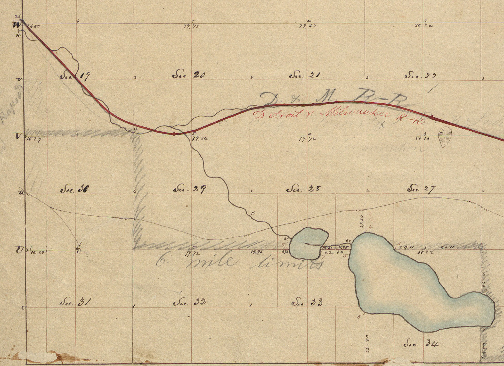
A portion of Township 7 North, Range 11 West from the government survey map of February 1831. In the lower right corner are what will become Fisk Lake and Reeds Lake. The Detroit & Milwaukee Railroad line continues across running east/west. Sections 19 and 30 on the left of the map become Grand Rapids Township, part of the original city of Grand Rapids along with Walker Township.
Subjects
Full Details
| Title | 1831 Survey East of Grand River |
|---|---|
| Creator | US Government |
| Date | 1831 |
| Format | Digital image downloaded from the Bureau of Land Management web site. |
| Notes | Title by cataloger. The Detroit & Milwaukee RR did not exist when the map was drawn and would have been added later. It began in 1858. |