
1837 Survey North of the Rapids
US Government - 1837
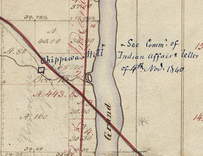
In section 13 which is just north of section 24 (and north of the rapids) the Chippewa Mill is drawn on the west side of the river. At the right is the notation, "See Comm of Indian Affairs letter of 4th Nov 1840." The crossing red lines on the map depict the Grand Rapids & Indiana Railroad running north and south, and the Detroit & Milwaukee Railroad running northeast to southwest.
Subjects
Full Details
| Title | 1837 Survey North of the Rapids |
|---|---|
| Creator | US Government |
| Date | 1837 |
| Format | Digital image downloaded from the Bureau of Land Management web site. |
| Notes | Title by cataloger. The notation dated 1840 and the Chippewa Mill were obviously added after the survey map was drawn as were the rail lines. The GR & Ind. line began in 1867, and the Det. & Mil. line in 1858. |