
1837 Survey west of Grand River
US Government - 1837
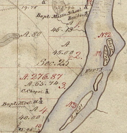
Section 25 and a portion of Section 36 of the June 1837 government survey map of Township 7 North, Range 12 West. On the west of the Grand River at the south end of the rapids is the Baptist Mission School and Residence. Farther south is the C. Chapel and below that the Baptist Meeting House. A dotted line indicates the route of the Ferry. Islands are more accurately depicted than in the 1831 map.
Subjects
Full Details
| Title | 1837 Survey west of Grand River |
|---|---|
| Creator | US Government |
| Date | 1837 |
| Format | Digital image downloaded from the Bureau of Land Management web site. |
| Notes | Title by cataloger. |