
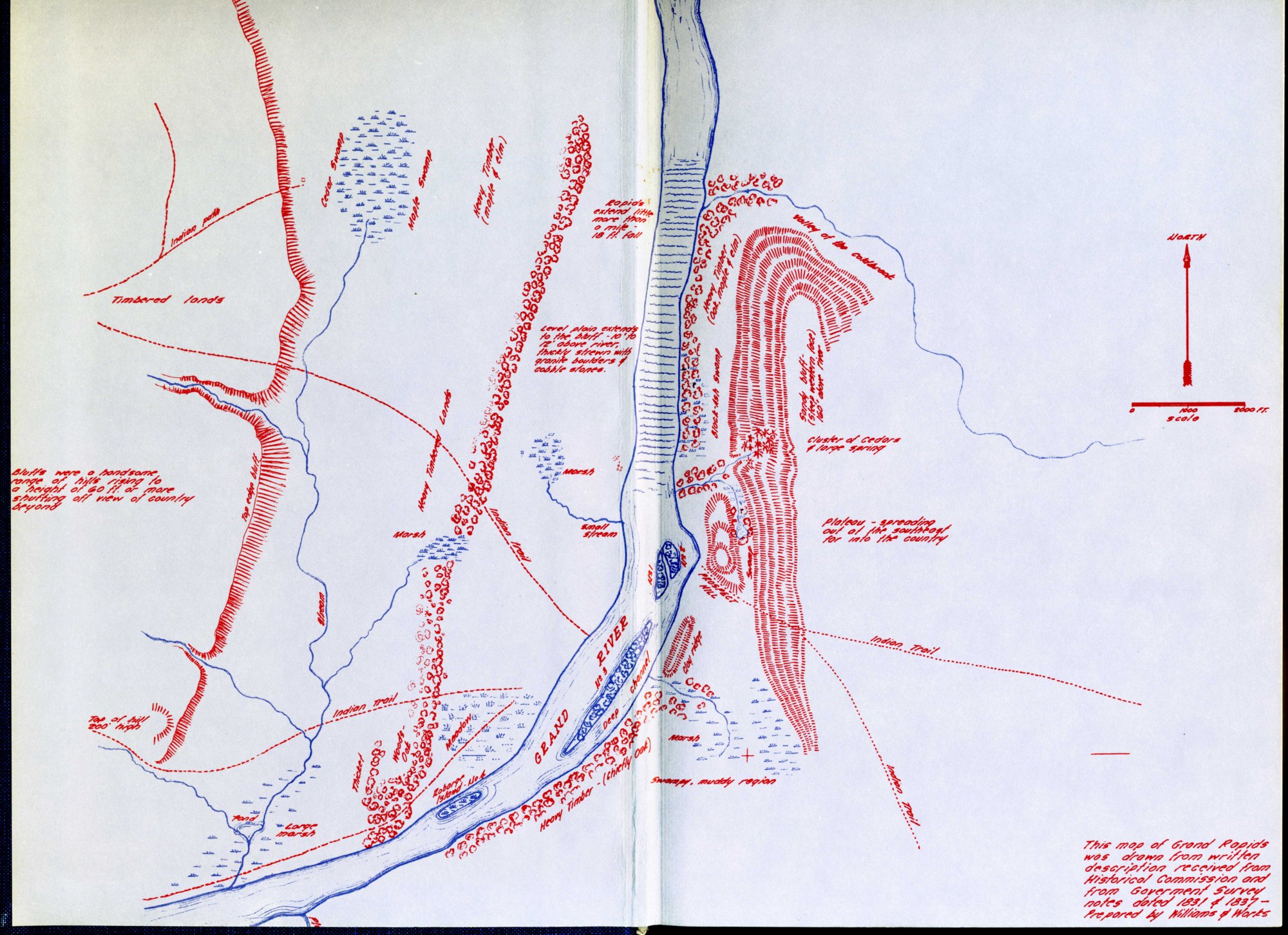
Topographical map of Grand Rapids, 1831
Williams & Works - 1965
The note in the lower right corner reads: This map of Grand Rapids was drawn from written description received from Historical Commission and from Government Survey notes dated 1831 & 1837--Prepared by Williams & Works.
Subjects
Full Details
| Title | Topographical map of Grand Rapids, 1831 |
|---|---|
| Creator | Williams & Works |
| Date | 1965 |
| Format | Map |
| Notes | Title by cataloger. Digital scan of the front end paper of The Story of Grand Rapids by Z.Z. Lydens, Editor, published 1966 by Kregel Pulications, Grand Rapids, MI. The center of the map is discolored by the fold of the book. |